During Atlantic hurricane season, a disturbance thousands of miles from Florida can become one of the most searched subjects in the United States within hours. A colored blob appears on a weather map. A forecast cone follows. Social feeds fill with model tracks. People from the Gulf Coast to the Carolinas begin asking the same questions: Where is it going? How strong will it get? Should I be worried?
The best place to begin is not a viral screenshot or a single computer model. For the United States, the authoritative source for Atlantic tropical-cyclone forecasts is NOAA's National Hurricane Center in Miami. Its maps can look intimidating, but they are designed to communicate several different kinds of risk—and understanding what each one means makes hurricane coverage much less confusing.
There is also a timely reason for heightened attention in early September. NOAA climatology places the historical peak of Atlantic hurricane activity on September 10, with most activity occurring between mid-August and mid-October. Peak season does not guarantee that a storm will exist on any particular day; it simply means the atmospheric and oceanic calendar has entered its most historically active stretch.
First: a hurricane outlook is not a hurricane forecast for your house
NOAA publishes a seasonal Atlantic hurricane outlook describing how active the entire basin is expected to be. The Atlantic basin includes the North Atlantic, Caribbean Sea and Gulf. The official season runs from June 1 through November 30, although tropical cyclones can occasionally form outside those dates.
NOAA's updated outlook for the 2026 Atlantic season favors a quieter-than-normal year. It gives a 75 percent chance of a below-normal season, a 20 percent chance of near-normal activity and a 5 percent chance of an above-normal season. The updated ranges call for 7–13 named storms in total, 2–6 hurricanes and 0–2 major hurricanes.
Those numbers are useful for understanding the season as a whole. They cannot tell a resident of Tampa, New Orleans, Charleston or New York whether a hurricane will strike that city. NOAA explicitly describes its seasonal product as an outlook for overall activity, not a landfall forecast. A below-normal season can still contain a destructive landfalling hurricane; an extremely active season can send many storms harmlessly over open water.
The current seasonal outlook can be checked through NOAA's Climate Prediction Center.
What the Tropical Weather Outlook actually tells you
Before a tropical storm receives a name, the National Hurricane Center monitors areas of disturbed weather that could develop. Its Tropical Weather Outlook identifies systems with potential for tropical-cyclone formation and assigns probabilities over specified time periods.
This is the source behind the familiar colored areas that weather watchers often call “invests,” “blobs” or development zones, although those terms are not interchangeable. The outlook is about the probability that a tropical cyclone will form, not necessarily the probability that a hurricane will hit land.
A system can have a high chance of development and remain far from the United States. Another can have relatively little time to organize before producing dangerous rainfall near land. Location, steering currents, moisture, wind shear and ocean conditions all matter after formation.
As of the latest National Hurricane Center Atlantic outlook available during research for this article on September 10, 2026, tropical cyclone formation was not expected in the Atlantic basin during the following seven days. The accompanying tropical-weather discussion nevertheless described tropical waves, including one approaching the Cabo Verde Islands and another east of the Lesser Antilles. That distinction is useful: tropical waves are common atmospheric features, and the presence of one does not automatically mean a tropical storm is about to form.
Because this information changes several times a day, readers should always use the live National Hurricane Center page rather than treating any article, screenshot or social-media post as a permanent forecast.
The forecast cone does not show the size of the storm
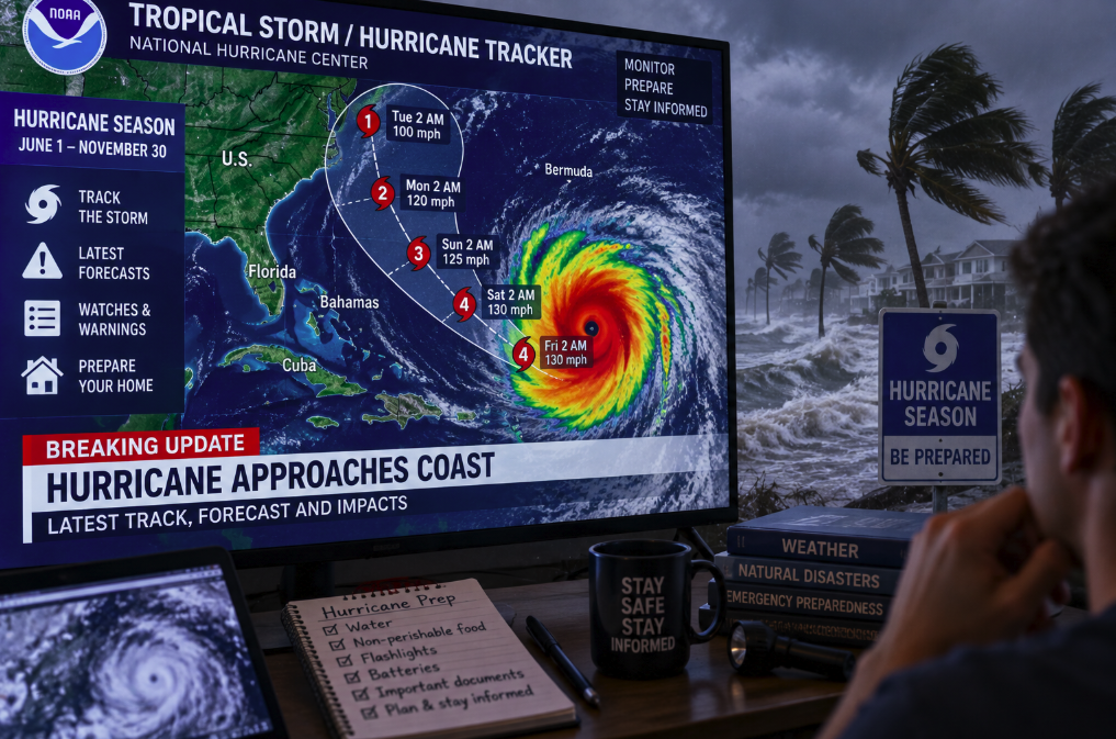
The “cone of uncertainty” is probably the most famous hurricane graphic—and one of the most misunderstood.
The cone represents the probable region for the center of a tropical cyclone based on historical forecast errors. It is not the physical footprint of the hurricane. A large storm can produce damaging winds, rain, waves and storm surge well outside the cone. Conversely, being inside the cone does not mean the storm's eye is guaranteed to pass over that location.
The cone also widens farther into the future because track uncertainty increases with time. A narrow area close to the storm reflects greater confidence about its near-term center position; the broad end several days away reflects the growing range of plausible tracks.
Another common mistake is to focus obsessively on the thin center line. That line is a forecast track, not a railway. Small shifts are normal as new observations enter the models and forecasters update their analysis. If a community lies near the cone, repeatedly celebrating or panicking every time the center line moves a few miles misses the purpose of the graphic.
For the 2026 season, the NHC introduced enhanced cone graphics that incorporate tropical-storm and hurricane watches and warnings for inland areas, making the relationship between track uncertainty and actual hazard alerts easier to see.
Watch and warning are not synonyms
These two words carry specific operational meanings. A hurricane watch means hurricane conditions are possible within the specified area. A hurricane warning means hurricane conditions are expected somewhere within that area.
According to the National Hurricane Center, hurricane warnings are generally issued about 36 hours before the anticipated onset of tropical-storm-force winds. That timing matters because many preparations become difficult or dangerous once strong winds have already arrived.
Tropical-storm watches and warnings perform a similar function for tropical-storm conditions. Coastal residents should also pay close attention to storm surge watches and warnings, because water rather than wind is often the most life-threatening part of a landfalling hurricane.
A local National Weather Service office may issue additional information tailored to specific counties or parishes, including expected conditions and evacuation information from local officials. This is why the best hurricane information becomes increasingly local as a storm approaches.
Storm category tells you only about wind
When a tropical cyclone's maximum sustained winds reach 74 mph, or 64 knots, it is classified as a hurricane in the Atlantic and eastern and central North Pacific. The Saffir-Simpson Hurricane Wind Scale then assigns categories from 1 through 5. Major hurricanes are Categories 3, 4 and 5, beginning at sustained winds of 111 mph.
But the category describes wind intensity. It does not directly measure rainfall, storm surge, tornado risk or the geographic size of the storm.
This is why a lower-category hurricane—or even a tropical storm—can produce catastrophic flooding. A slow-moving system can unload enormous rainfall totals. A large storm can push seawater toward the coast across a wide area. Terrain, tides, coastal shape and the angle of approach can dramatically change local impacts.
As a result, “It's only a Category 1” is not a safe way to interpret a forecast. Category is one useful number inside a much larger hazard picture.
Why storm surge deserves its own map
Storm surge is an abnormal rise of seawater generated primarily as a storm's winds push water toward the coast. When surge combines with the normal astronomical tide, water can move into places that are normally dry.
The danger is highly local. A few feet of additional water can transform streets, barrier islands and low-lying neighborhoods, while the shape of bays and coastlines can amplify flooding. Evacuation zones are therefore often based heavily on vulnerability to storm surge rather than simply distance from the forecast track.
If local authorities order an evacuation because of surge, the relevant question is not whether the forecast cone's center line passes directly over your home. Water does not respect that line.
Why forecasts change—and why that does not mean forecasters were “wrong”
A hurricane forecast is a prediction of a chaotic atmosphere, updated as new evidence arrives. Satellites monitor cloud structure and atmospheric motion. Aircraft can fly into and around threatening storms to measure pressure, wind and moisture. Ocean buoys, radar, weather balloons and other observing systems feed data into numerical models.
Forecasters then interpret those models rather than blindly choosing one. Different models can disagree because they represent the atmosphere differently or begin with slightly different estimates of current conditions. Small initial differences can become larger over several days.
A track that shifts between advisories is therefore not necessarily evidence of failure. Updating a prediction when better information becomes available is exactly what a forecasting system should do. The farther into the future the prediction, the greater the uncertainty generally becomes.
This is also why isolated model runs circulating online can be misleading. A dramatic ten-day map may look precise while representing only one possible simulation far beyond the period where confidence is high.
What to monitor if you live on the East or Gulf Coast
During hurricane season, the simplest information hierarchy is also the most reliable. Start with the National Hurricane Center for basin-wide tropical activity and official cyclone forecasts. Use your local National Weather Service office for detailed local hazards. Follow emergency-management and evacuation instructions from state and local authorities when a storm threatens.
Preparation should happen before a warning appears. NOAA recommends having an evacuation plan, assembling supplies such as water, food, batteries and charging options, reviewing insurance, documenting possessions and creating a family communication plan. Waiting until tropical-storm-force winds are hours away is precisely when roads, stores and fuel supplies can become most stressed.
And remember what a quiet map means. It means conditions are quiet now, not that the remainder of hurricane season has been canceled. The Atlantic's official season lasts through November 30, and NOAA notes that storms have occasionally occurred outside the formal season as well.
The most useful hurricane habit is therefore neither panic nor complacency. It is knowing where the official information lives, understanding what the maps actually say and preparing early enough that a changing forecast remains information—not a crisis.