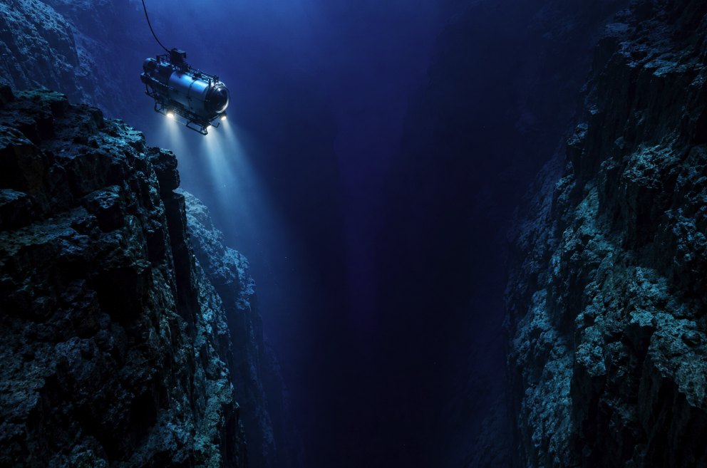
There is a place on Earth where Mount Everest could be lowered beneath the waves and its summit would still remain underwater. It lies in the western Pacific, in the Mariana Trench, where the seafloor plunges into one of the most extreme environments known on our planet. At its deepest measured point, Challenger Deep, the bottom is about 10,935 meters below mean sea level — nearly 11 kilometers down.
That number is difficult to visualize because everyday experience gives us almost no sense of such vertical distance. The average ocean is already about 3,682 meters deep, according to NOAA Ocean Exploration. Challenger Deep descends roughly three times farther. Down there there is no sunlight, temperatures are low, and the pressure is immense.
The Mariana Trench has consequently become a symbol of a broader scientific paradox. Humanity can send spacecraft across the Solar System and construct detailed maps of distant planetary surfaces, yet large portions of the terrain beneath our own oceans have never been mapped directly at modern high resolution. The familiar claim that we “know more about Mars than the ocean floor” is an oversimplification, but it points toward something real: obtaining detailed measurements beneath kilometers of seawater remains remarkably difficult.
A scar created by a moving planet
The Mariana Trench is not simply an underwater canyon. It exists because Earth’s crust is active. In this region, the Pacific Plate is forced beneath the smaller Mariana Plate in a process called subduction. The descending slab bends into the mantle, producing the long, curved depression of the trench. NOAA describes the trench as more than 2,500 kilometers long, making it a geological structure on a continental scale.
Its best-known section is Challenger Deep, named for HMS Challenger. During the pioneering Challenger expedition, a British crew made a sounding in the Mariana region in 1875 using a weighted line and recorded a depth of 8,184 meters. The measurement was crude by modern standards, but it was an extraordinary glimpse into a world that could not yet be visited.
That changed dramatically on January 23, 1960. Swiss oceanographer Jacques Piccard and U.S. Navy Lieutenant Don Walsh descended in the bathyscaphe Trieste to the bottom of Challenger Deep. The journey demonstrated that humans could reach the deepest ocean even under crushing pressure. More than half a century later, filmmaker James Cameron made a solo descent in 2012, and subsequent expeditions using crewed submersibles, remotely operated vehicles, autonomous systems and instrumented landers have returned to the hadal depths.
Modern measurements have also refined the numbers. A study based on submersible transects during dives in 2020 estimated the deepest observed seafloor at 10,935 meters, with an uncertainty of about six meters. That precision illustrates how far oceanography has progressed from lowering weighted rope over the side of a ship.
Why exploring downward is so difficult
Space is hostile, but the deep ocean creates a different engineering problem: pressure increases relentlessly with depth. At Challenger Deep, equipment must survive roughly a thousand times atmospheric pressure at sea level. Tiny structural weaknesses can become catastrophic. Electronics, cameras, batteries, housings and sampling instruments all have to operate reliably in darkness and cold while being separated from researchers by almost 11 kilometers of water.
Communication is another obstacle. Radio waves that make spacecraft communication possible do not travel efficiently through seawater. Deep-sea vehicles often depend on acoustic communication, while tethered remotely operated vehicles use cables to transmit power, commands and data. Every solution brings trade-offs in speed, range, complexity and cost.
Even reaching the target requires time. A research vessel must travel to remote ocean regions, deploy specialized instruments and systematically survey enormous areas. High-resolution bathymetric mapping commonly uses multibeam sonar: a ship sends sound pulses toward the seabed and reconstructs the landscape from the returning echoes. The technique can reveal mountains, trenches and other features in impressive detail, but the vessel has to physically cross the ocean above the territory being mapped.
This is why satellite maps of the ocean floor should not be confused with direct high-resolution surveys. Satellites can infer broad seafloor structure by measuring subtle variations in the height and gravitational shape of the sea surface. They give scientists a global picture, but they cannot provide the same detail as shipborne sonar.
How much of the seafloor have we actually mapped?
The answer depends entirely on what “mapped” means. At coarse resolution, the whole ocean floor can be represented using satellite-derived information and available measurements. At modern high resolution, however, the gaps remain enormous. NOAA reported in April 2026 that only 28.7 percent of the global seafloor had been mapped using modern high-resolution technology such as multibeam sonar.
That is the useful truth behind the often-repeated Mars comparison. Planetary spacecraft can map exposed terrain remotely because there is no opaque ocean sitting above it. Earth’s seabed, by contrast, is hidden beneath a moving layer of saltwater that can be several kilometers thick. We possess global models of it, but much of the fine-scale topography still awaits direct modern survey. NOAA itself has noted that we know less about the ocean floor than the surfaces of the Moon and Mars in this high-resolution mapping sense.
The international Seabed 2030 initiative, a collaboration involving the Nippon Foundation and the General Bathymetric Chart of the Oceans, was created to accelerate the construction of a comprehensive map of the global seafloor. The challenge is enormous. Better autonomous vehicles, improved sonar, data sharing and uncrewed surface vessels may make mapping faster, but the ocean covers most of Earth.
The abyss is not empty
Perhaps the most surprising lesson from deep-ocean exploration is biological. Beyond about 1,000 meters, sunlight is absent, so photosynthesis cannot support ecosystems directly. Yet life persists even in the hadal zone, the deepest region of the ocean associated with trenches. Researchers have observed highly adapted invertebrates and microorganisms at extreme depths, while fish appear to encounter a physiological limit before reaching the very deepest floor. NOAA notes that research suggests a pressure-related boundary around 8,200 to 8,400 meters below which fish may be unable to survive, although invertebrates live deeper.
The Mariana region is also geologically and chemically unusual. Hydrothermal systems, submarine volcanoes and extreme environments create habitats unlike those at the surface. Studying organisms adapted to high pressure, low temperatures and scarce food is not merely an exercise in cataloguing strange animals. It can reveal how biological molecules function under conditions that would destroy many familiar forms of life, while deep-sea sediments and water chemistry preserve information about carbon cycling, plate tectonics and Earth’s climate system.
Exploration also repeatedly reminds scientists that remoteness does not mean isolation. Human-made pollutants have been detected in deep marine environments, demonstrating that even trenches far below the surface are connected to processes occurring in the rest of the planet.
The frontier beneath us
The fascination of the Mariana Trench comes partly from its scale, but its real scientific importance is larger than a record depth. Challenger Deep is an extreme point in an immense environment that remains difficult to observe directly. Each expedition is expensive and technically demanding, yet it can return geological maps, biological specimens, chemical measurements, acoustic recordings and images from places humans have rarely seen.
We should therefore be careful with the seductive idea that the ocean is simply “unknown.” Scientists understand a great deal about ocean circulation, chemistry, ecosystems and global seafloor structure. What remains incomplete is detailed, direct observation across a staggering area and volume. That distinction makes the reality more interesting, not less.
Mars is tens of millions of kilometers away even at favorable times. Challenger Deep is on our own planet. Yet to place an instrument on its floor requires surviving darkness, cold and a column of water almost 11 kilometers high. The deepest ocean reminds us that a frontier does not have to be in space. Some of the least visited landscapes accessible to humanity are directly beneath the waves.